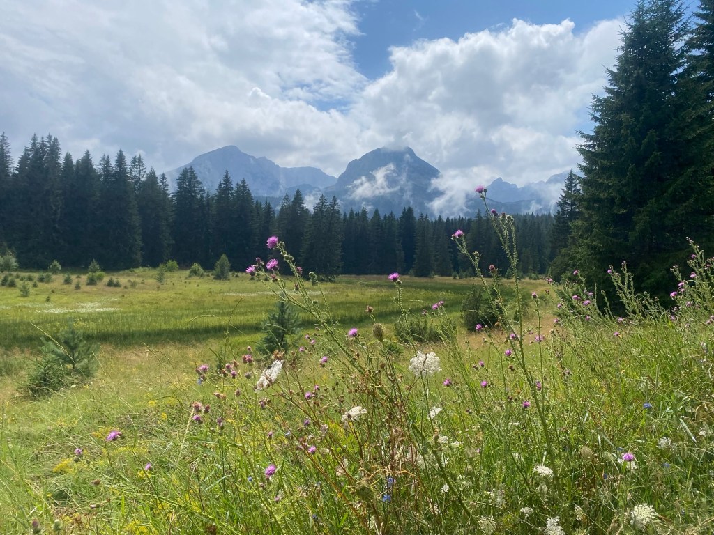
In my preparation for my trip I had looked a few places to go hiking and to explore the nature in the Balkans. In Montenegro, Durmitor National Park was a destination that came up multiple times as I worked through where I could go. It did not disappoint.
In looking at HostelWorld I came across the Hiker’s Den Hostel in Zabljak, the town on the edge of Durmitor National Park. The Hiker’s Den, as its name suggests, is a hostel focussed on supporting outdoor adventurers who come to Zabljak to see the National Park. In addition to the usual hostel accommodations and cooking facilities, the owners are passionate about hiking and provide detailed information on what to do, access to equipment if people need this, and ensure that they have a good sense of what people are doing in case their is any difficulty in their adventures.
Zabljak felt like a classic mountain town. Small but with lots of companies to support various outdoor pursuits and willing to help coordinate activities. And a number of small shops selling items related to Durmitor or Montenegro for the tourist crowd. A number of resorts and rental properties could be seen in the valleys around Zabljak and lots of building was occurring. It felt a bit like the Canmore, Alberta, that I remember from my youth.
I spent three nights at the Hiker’s Den, which allowed a fair bit of time to explore what Durmitor had to offer. The weather was not overly cooperative as the last couple days were wet and thus put the damper on outdoor pursuits. I debated staying longer, but the poor weather was going to continue for a couple days which meant I missed the opportunity to hike to the highest peak in Montenegro, Bobotov Kuk. Despite this, I was able to see and do a lot.
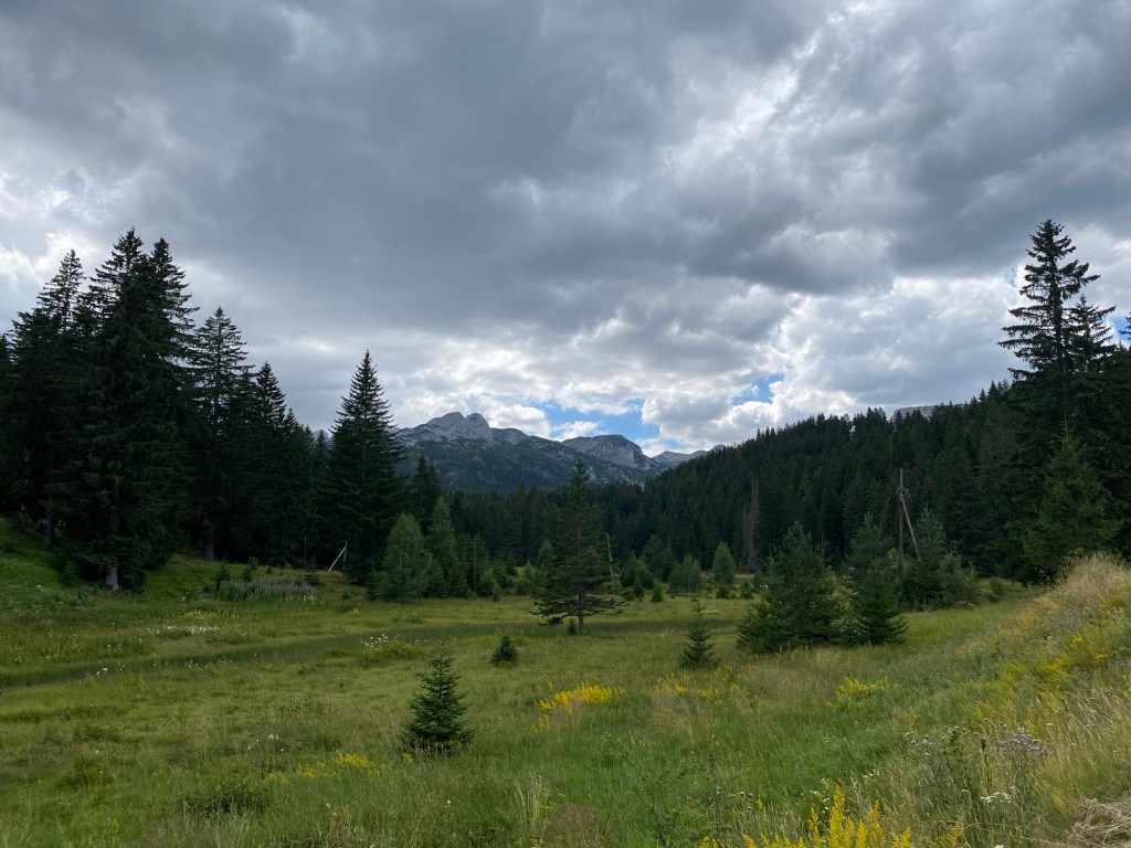
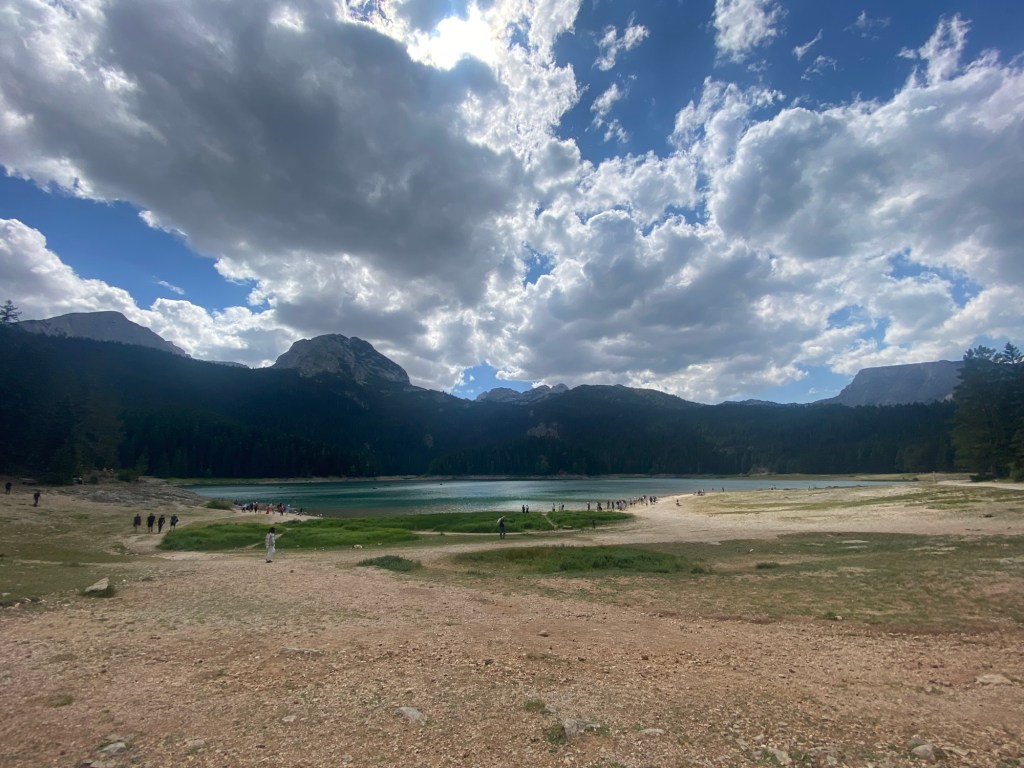
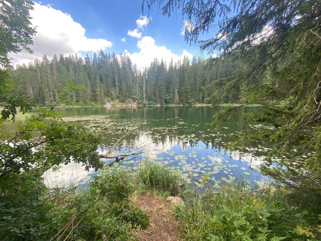
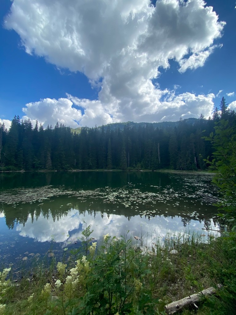
I arrived Sunday just after noon and was encouraged by the hostel owners to do a shorter, “three to four hour”, hike around the three lakes. I wondered down from the hostel through Zabljak’s Main Street that led, after just over two kilometres, to the gates of Durmitor National Park. Another kilometre on a paved walkway, the Black Lakes revealed themselves. This lake is two lakes connected by a small channel. A around the two allowed me to see the mountain lakes with their azure colouring from various angles. Despite a sign saying the back part of this path was “dangerous”, the number of families with small children navigating the rocky and rooted path belied the level of risk. After circumnavigating the first lake, I headed further into the path on a well worn trail that connected with an old road that led to the second of the three lakes, Zminje Lake. This was a small serene lake with some of the Durmitor mountains towering behind it, making for an idyllic setting. From there a return down the path and a turn just north of the Black Lakes led to Barno Lake, a swampy smaller lake on a lower area of land. It was a nice easy hike that was around five kilometres. A good way to start the exploration of Durmitor National Park.
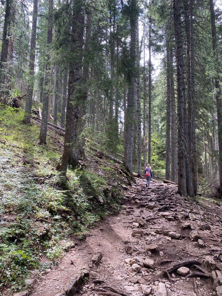
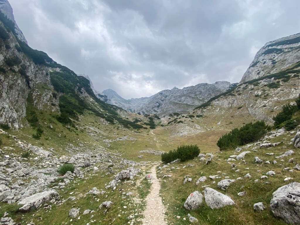
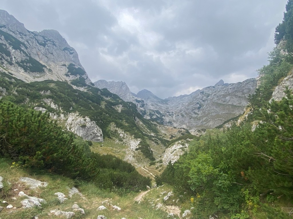
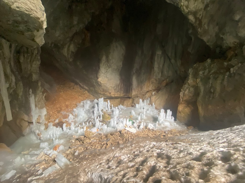
On the second day I was encouraged to hike to the Ice Cave. Said to be an 8-10 hour hike from the hostel to the return. For a few people at the hostel this was their favourite hike they had done whihc sold me on taking it on next. It was a great way to get deep into the Durmitor mountains as the path had a loop that took you over a few passes and down through a number of mountain valleys. It started out past the north end of the Black Lakes and curved south to where the trail split at the start of the circular trail. Most of the first hour was spent in forested areas before, after the trail split, you were largely past the tree line scrambling on the rocky terrain. The trail had a few steeper sections as you went up and down, but revealed beautiful vista’s of the various peaks of the Durmitor range despite the low hanging cloud. In one of the valleys I passed a shepherd with his flock of sheep and a couple sheepdogs. This added to the scenic adventure of walking this path. As I climbed to around the 2000 metre mark after one long climb, I got to a junction where you could keep going to Bobotov Kul, or turn to the ice cave. I took the right hand path across the face of a mountain that climbed towards the ice cave. About 25 minutes on, i got to the cave opening. It was a deep cavernous cave that had a sixty degree decent to where you could see ice in what looked like stalagmites at the bottom about fifty metres down. I climbed about two thirds of the way down before feeling like the slippery ice and my being relatively alone at the cave—I had seen a couple other climbers coming up the other side of the path, but they weren’t up to the cave yet—made me cautious about going all the way down. Despite this I got to see how the water dripping from the cave roof was creating this ice stalagmites at the base of the cave. It made for an interesting and unusual image. After climbing out of the cave, I started the return trip. The north side of the circular route was very steep and felt a bit more tenuous to climb than the path coming out. I descended fairly rapidly for the first hour before I got into a more treed area. The path from there wound in and out of forested and rocky sections through some overgrown parts where I had to squeeze between branches. About half way back the rain started coming down making for a fairly wet adventure. I was glad i wasn’t on the steeper sections with this downpour. Despite the rain, it was a very enjoyable adventure. The sixteen kilometre hike took me just under eight hours to complete.
The rain continued into day three making hiking seem less desirable. The hosts at the hostel suggested it was likely to start clearing a bit after 1000. On my arrival they had told me about a few places you could cycle to and do some exploration. They had three different locations with 42 kilometres of biking that were suggested. I knew my fitness on a bike would not allow me to complete all of this, but thought I would take on the cycle and short hike to see the Tara Canyon, the deepest gorge in Montenegro. Despite having the direction in my GPS, I missed one of my initial turners and, then in trying to correct through a cross country route, I likely added six kilometres onto what was supposed to be around an eighteen kilometre biking return journey. That will teach me not to look at the GPS more frequently. I eventually did get to the gates of the park at Tara Canyon. From there it was around a two kilometre hike up a gradual slope to a look out point. On my way into the park, I had cycled through some fog and was curious to see how this would impact the visuals. The hostel hosts had said that typically the clouds lift through the day and that I may need to give it some time. unfortunately, as I approached the lookout over the Tara Canyon, a wall of white cloud filled the gorge. I sat to eat my lunch and read a book with the hope that some time would allow for the cloud cover to lift. Over the better part of the next hour, i saw glimpses of the Canyon as the clouds moved across its face, but the general view remained largely shrouded in thick fog. Despite only getting the partial view of this canyon, i was glad to have got out to see it. I made my way back with some light rain and a mostly downhill return trip. I celebrated my adventures with a pistachio crepe at one of the local restaurants before relaxing from the previous three days of adventures as the rain came on in earnest through the afternoon.

Very cool! You’re a must-follow, BorealHiker
LikeLike