After taking a month at home in Saskatchewan through October, I am heading to South America. Currently I am in Toronto’s Pearson International Airport on my way via Washington, D.C., to São Paulo, Brazil. This will start a bit over six weeks in the Southern hemisphere to some countries I haven’t been to.
My first stop is Brazil for the first week. I am hoping to split the time between São Paulo and Rio de Janeiro. During this time I may do some some day trips out of the cities to explore some of the nearby sites.
Then I am heading to Argentina. For the past decade I have thought about doing a G Adventures tour called the “End of the Earth” that starts in Buenos Aires before doing some hiking in the Argentina and Chilean Patagonian mountains and then heading to the southern end of the continent to visit Ushuaia. I am looking forward to this two week adventure.
After this I am planning to cross the Bay of Guanabara to see some of Uruguay before heading northwest to Iguazu Falls on the borders of Paraguay, Brazil, and Argentina. From here I hope to explore Paraguay and continue on to Bolivia. A week before Christmas I am hoping to return to Canada for Christmas.
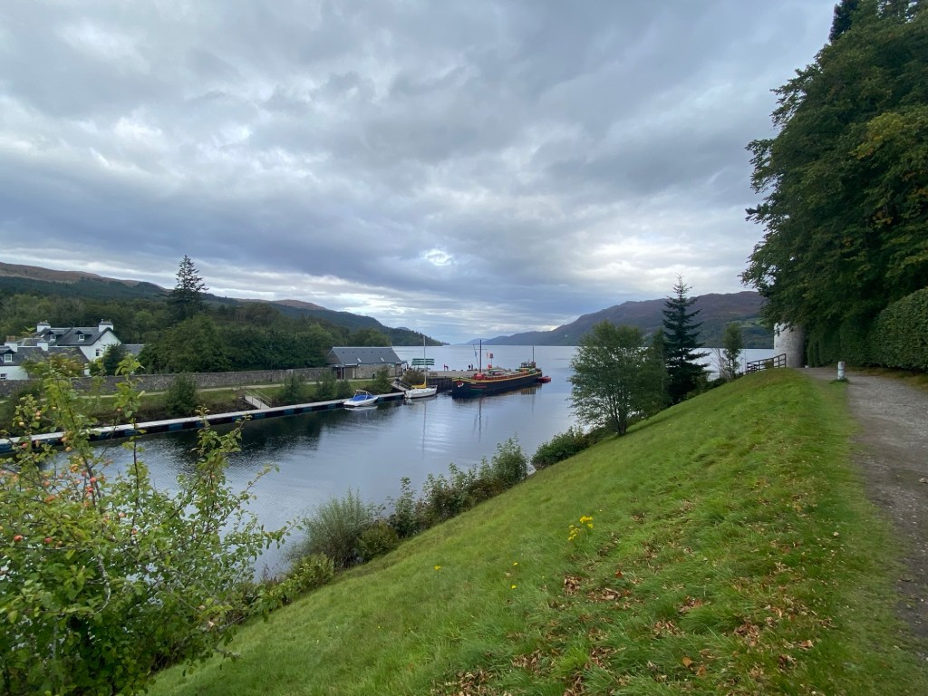
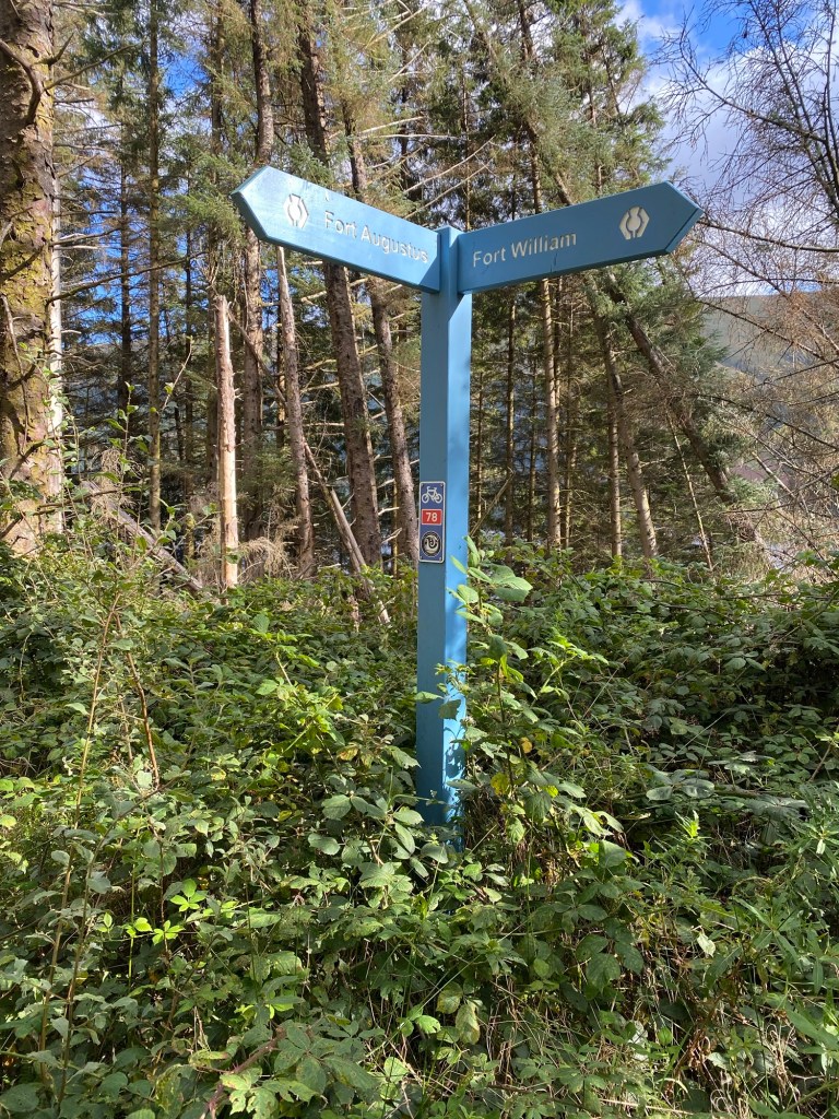
The final day of walking the Great Glen Way was going to be a longer one. By road it was around 28 kilometres, but the path took a slightly different route and was going to be over 30 kilometres.
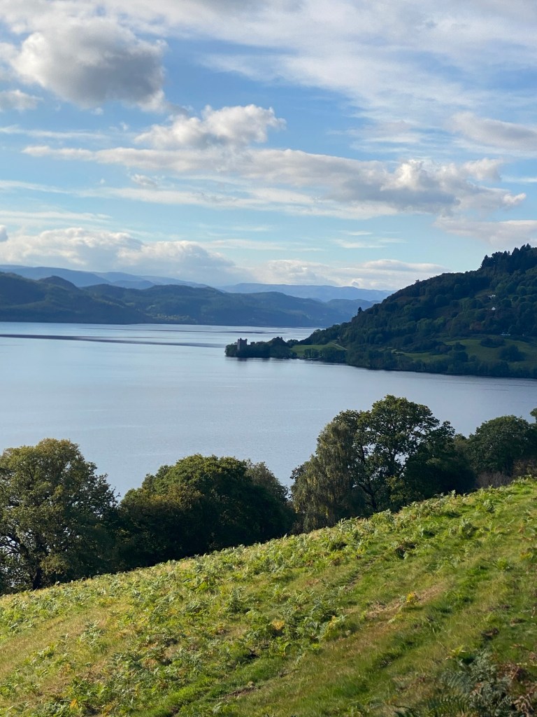
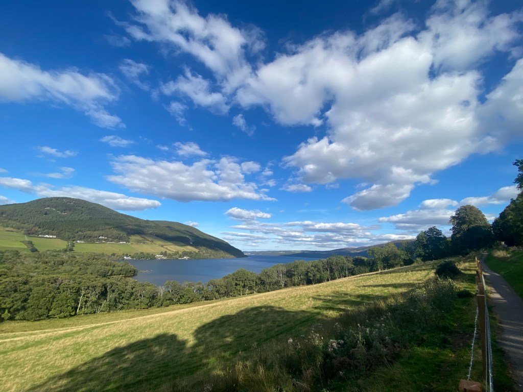
A look back at Urquhart Castle from the trail north of Drumnadrochit
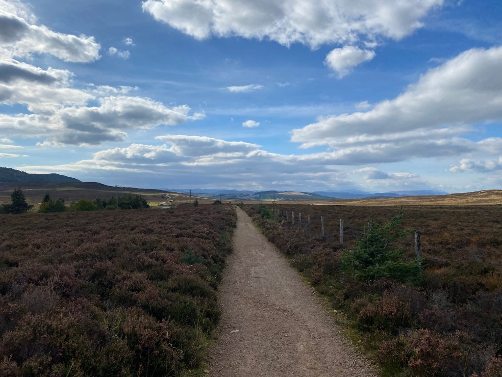
I left Drumnadrochit mid-morning after a nice breakfast and headed east along the A82 before cutting up to a path next to the road about a kilometre out of town. The path slowly rose in to the hills and the forest of Abriachan. At one point in the late morning there was a scenic route that provided a bit more elevation to climb but had some views over Loch Ness or a more direct route. Despite the extra steps, I chose to take the more scenic route.
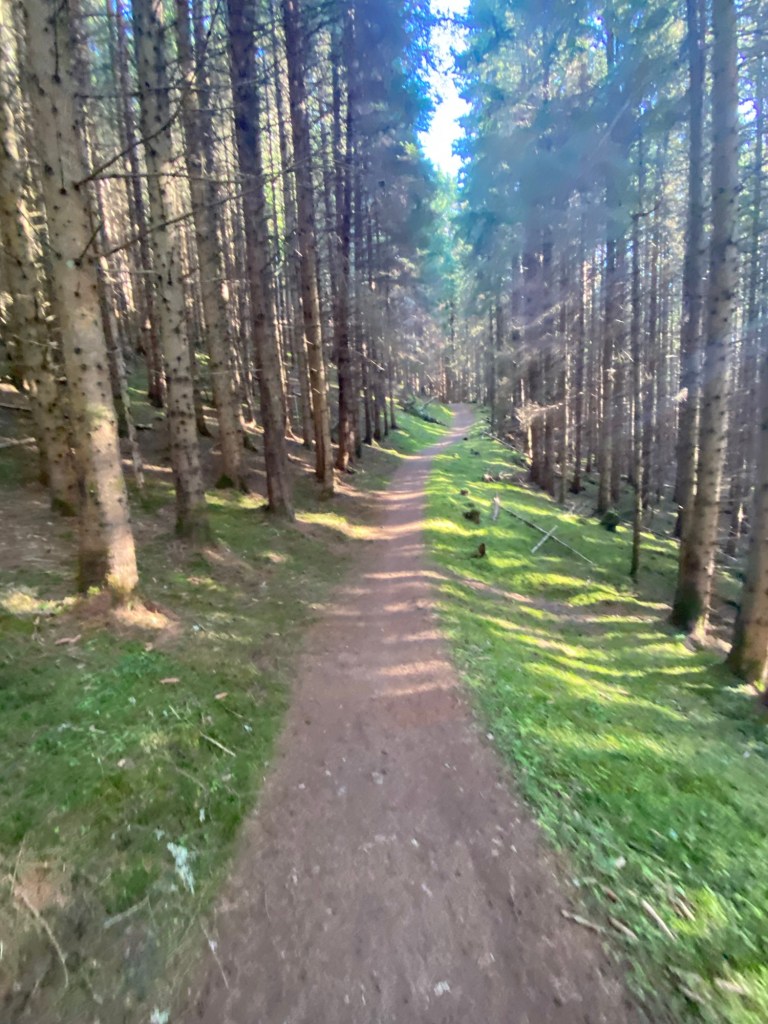
Abriachan forest path.At the high points on the trail.
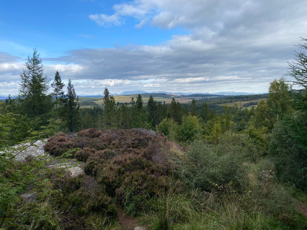
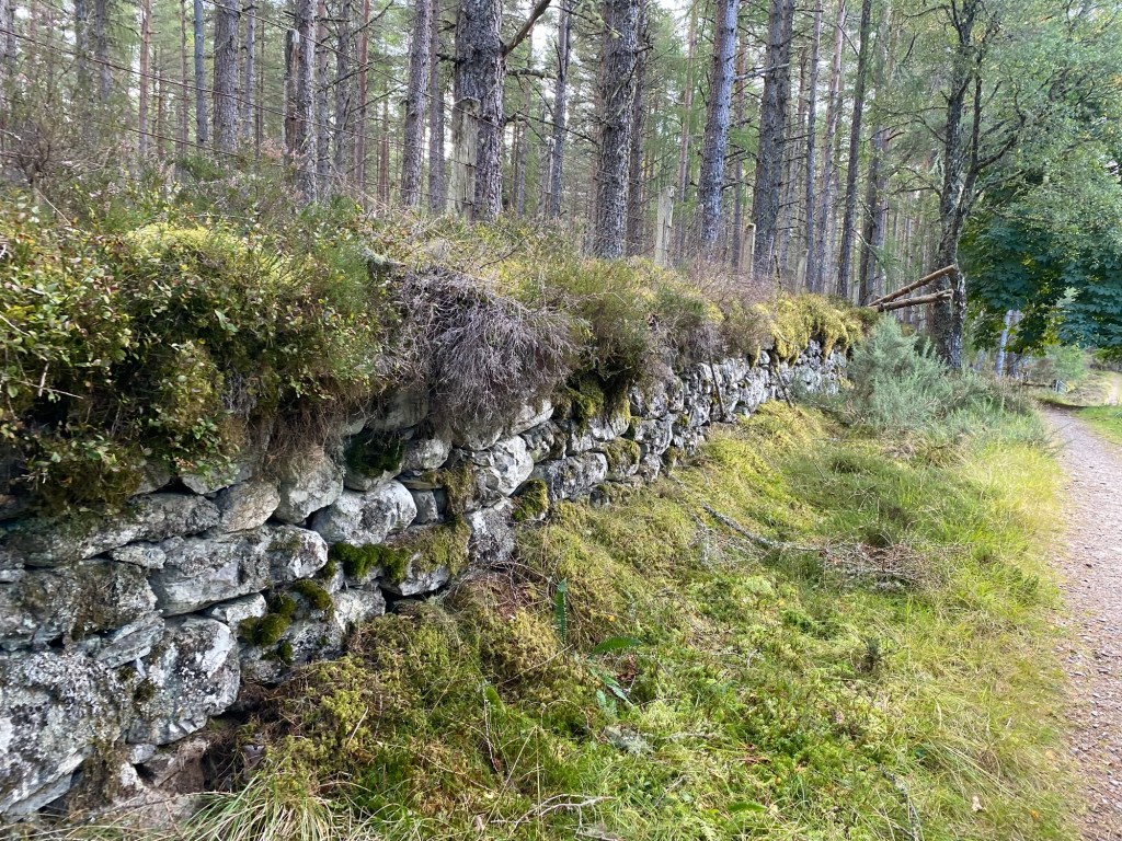
After I had stopped for lunch at a picnic area at the Abriachan campsite, I followed the smaller country roads and paths next to the roads for a couple hours. This road at some points gave a great view over the Highland mountains to the Northwest and made for an enjoyable walk with the views. As the day went on the path went back into forested areas with one section running next to an old stone fence for about three kilometres.
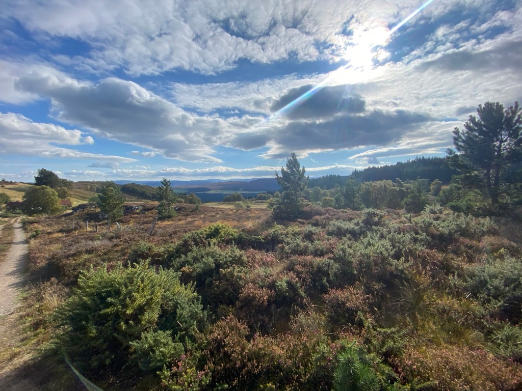
The Cairn at the high points in the Abriachan forest. The highland mountains in the distance. The stone fence beside the trail.
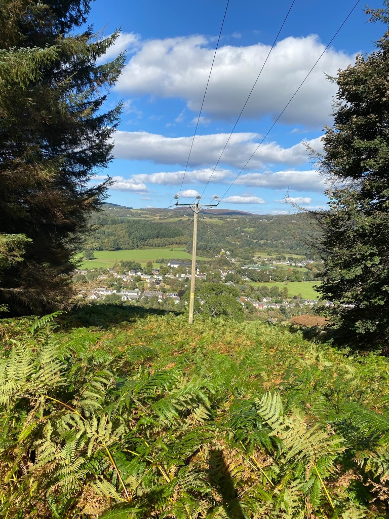
I knew I was getting closer to Inverness as I started seeing views of Beauly Firth and started seeing more houses. The path wound through fields and roads to the southwest of Inverness before coming into the Leachkin community on the outskirts of the city. On the way into Inverness, I passed the Highland Rugby Club where my Dad had played for the local team when he was younger. The path connected back to the Caledonian Canal before cutting towards the Ness River and taking me to the downtown of Inverness. The last stretch was a short uphill to the Inverness Castle. Although the Castle was undergoing renovations it was great to see the Great Glen trail marker and feel the accomplishment of finishing the hike.
First views of Inverness. At the trail marker outside of Inverness Castle.
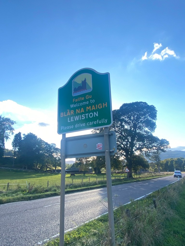
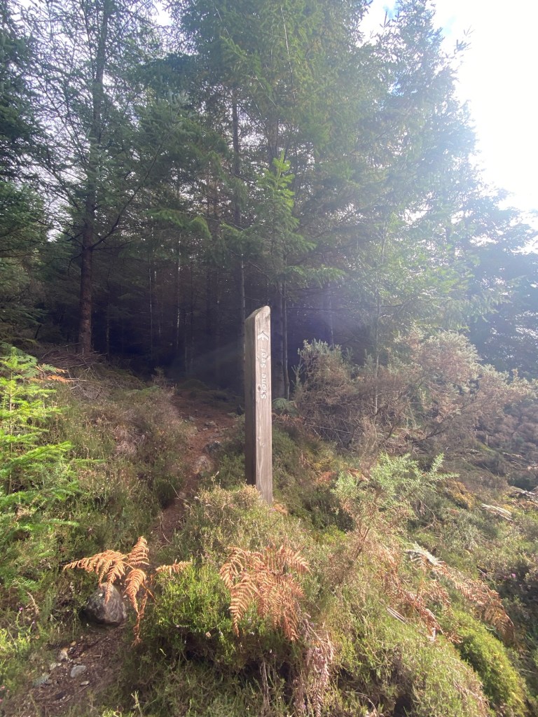
On Day five of my hike I was doing another 15-20 kilometres day walking from Alltsigh to Lewiston. My Dad had raved about his experience in Drumnadrochit the community is relatively blended into Lewiston.
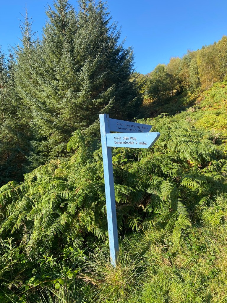
Sign post on day five of the Great Glen way.
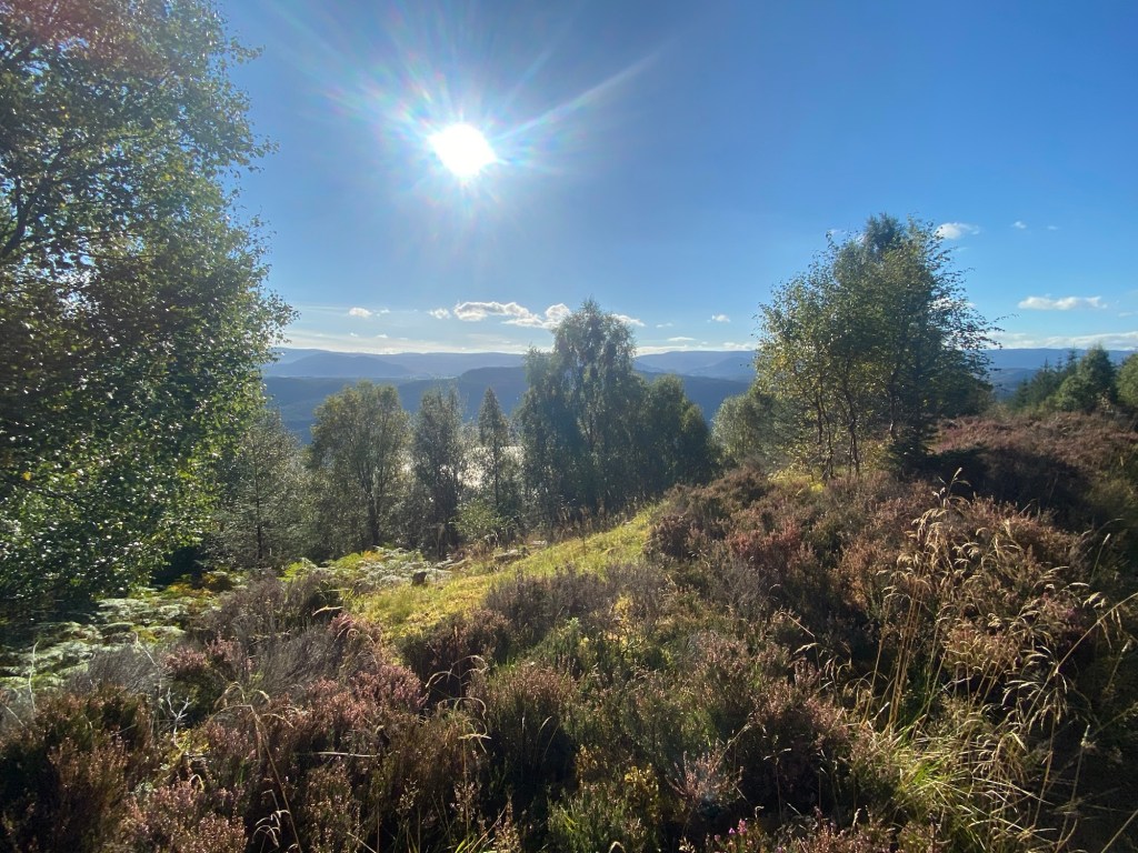
The hiking on this day was pleasant as the day was beautiful and sunny, yet not too warm. The path rose above the Loch Ness with views in between the trees. As the path got closer to Lewiston the trail merged onto country roads until, right before the road descended down the last hill, a path cut to the west taking me through a wooded and pasture area into the south end of Lewiston.
High point of hike on day five, just outside of Lewiston.
Lewiston and Drumnadrochit was a good place to stop with a number of nice coffee shops and restaurants. As well as some local sites to explore.
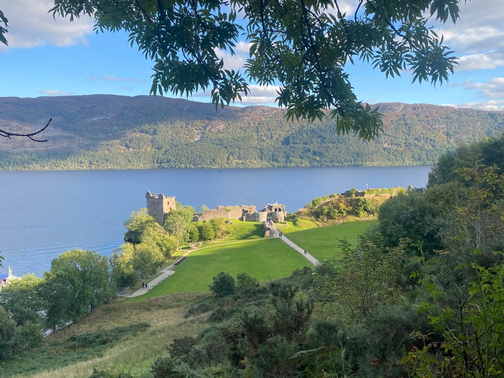
Lewiston and Drumnadrochit. Edge of Loch Ness on way to Urquhart Castle from Lewiston.
The modern focus on the Loch Ness monster has a base in Drumnadrochit with the Loch Ness Centre on the North end of Drumnadrochit. This multi-media experience tells the history of Loch Ness and its famed monster, providing the background going back centuries to Saint Columba and then the more modern sightings and scientific work done to try and find the alleged sea monster that people felt existed in Loch Ness. It was an interesting way to learn more about this.
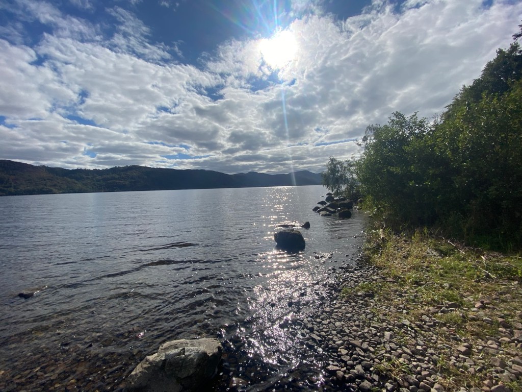
Later in the afternoon I walked the three kilometres south east of Lewiston to Castle Urquhart. This ruin of an old castle is managed by Historic Scotland. Enough of the ruins are there to give a sense of the space and the site does a solid job of telling the history of the location and its inhabitants. Inside the Visitor centre there is a video on the history. Then walking out from the Visitor Centre the site has a lot of plaques giving more information. Urquhart Castle sits on a site with over a millennium of history starting with Scottish Chieftains in the seventh century who liked the strategic location as an entry point to the highlands behind Loch Ness. Over time the site had become a home to the early Scottish kings and later captured by the England monarchy in 1296. Over the centuries it was attached and traded hands between various groups and raiding parties from the Islands and Highlands of Scotland. The Grant family was gifted it by the British monarchs in the 16th Century as a means of presence to offset growing Jacobite threats. They held it but were attacked by Jacobites in 1790 and fled the castle. When the Jacobites left they blew up the main gates and the site was left to ruin subsequently. In the 1990s Historic Scotland took control of the site to develop the tourist site I was able to visit.
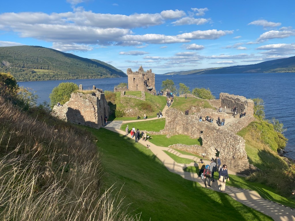
Urquhart Castle from the road above. Urquhart Castle from the Visitors Centre.
I ended the day at the Loch Ness Inn and the Lewiston pub for a tasty meal. I knew I had a long day ahead for my find day on the Great Glen Way.
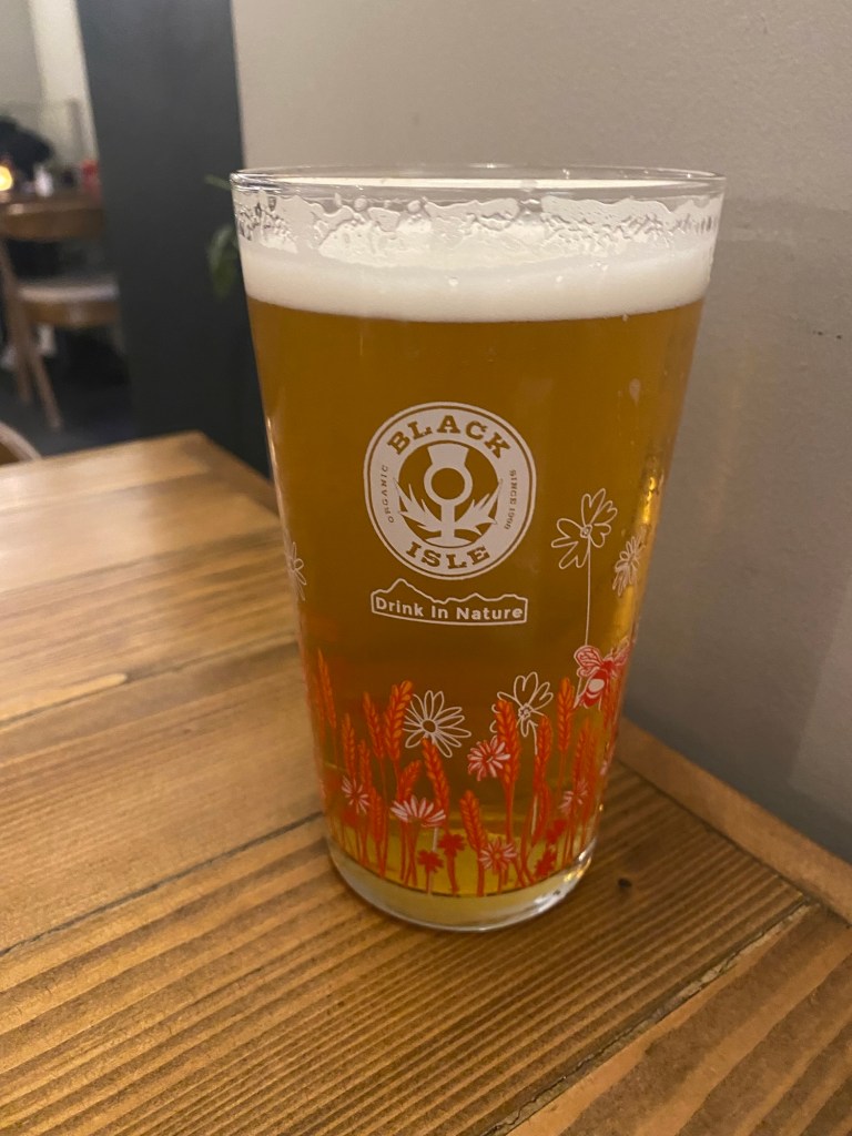
Goldfinch IPA from Black Isle Brewery. Part of my supper.
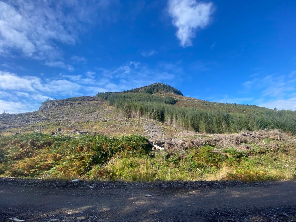
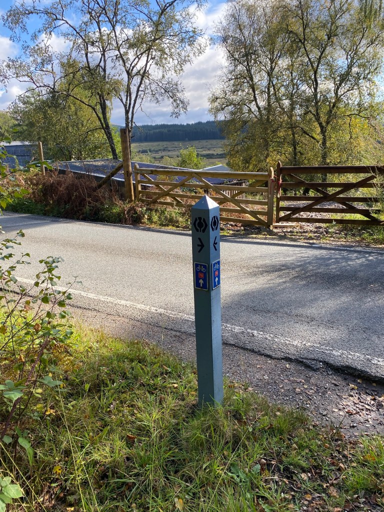
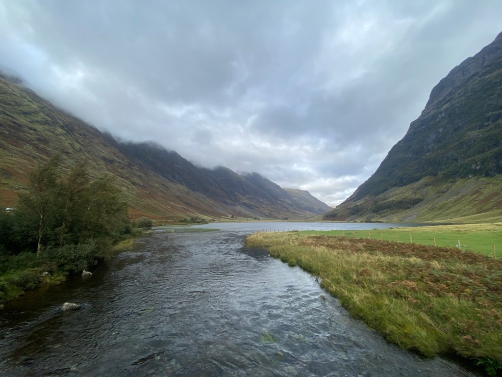
This was likely the least eventful day I had on the Great Glen Way. It was a nice walk along the west side of Loch Ness. The path went up above the loch for most of the day with the path taking me in and out of trees along logging roads and forest paths.
Roadside on the Great Glen way between Fort Augustus and Invermoriston.
I was aiming to get to Alltsigh where the Lochside Hostel was located. This meant I passed through Invermoriston about ten kilometers into the hike. It was a nice small town where I stopped at a shop to get some food for the hostel as there wasn’t a restaurant in Alltsigh that I could go out to.
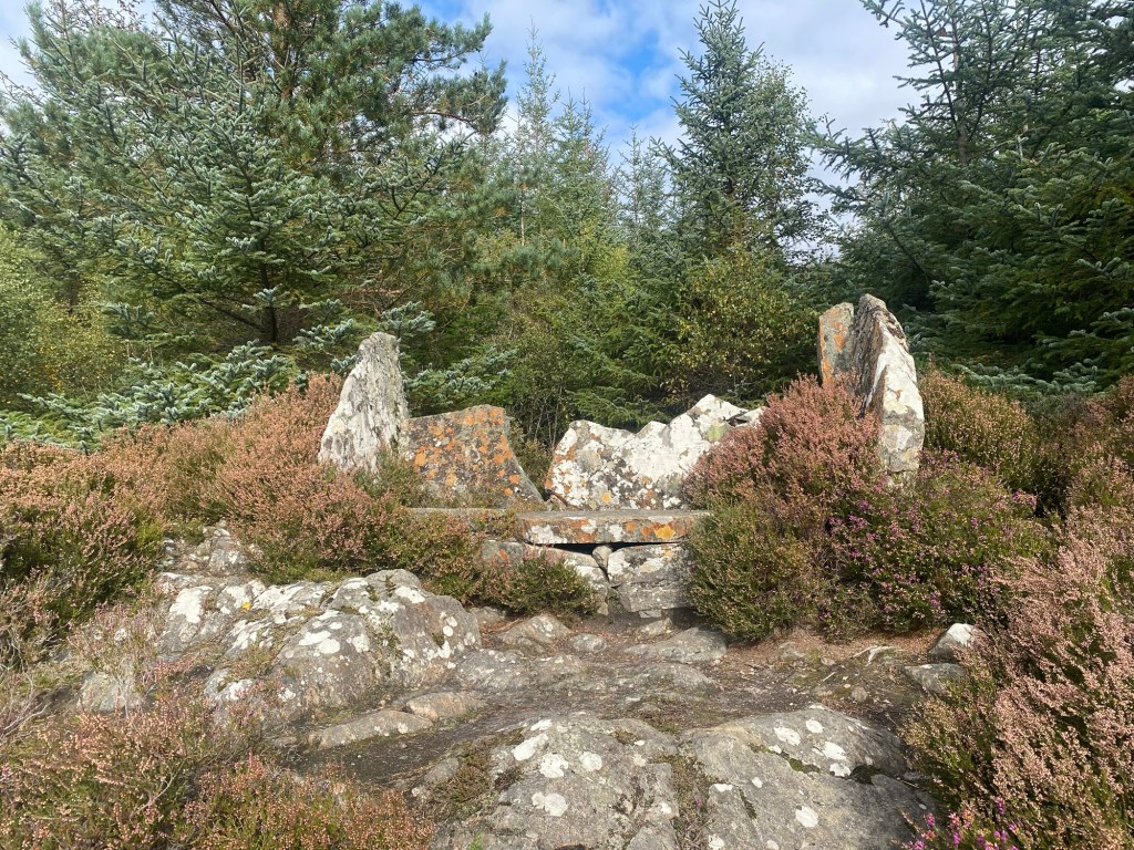
Signpost for the Stone seat. The stone seat above Invermoriston.
Just outside of Invermoriston the path climbed up a steep rise and I ran into a number of other hikers. It seemed to be a nice day hiking area with a loop that people could take. I was taking the low route of the Great Glen Way as this was a more direct path to Alltsigh. At one point, just outside of Invermoriston, a signpost for a stone seat was beside the path. The indication was about 100 metres to the point. I climb through a slightly overgrown path and found a stone seat on what may have been a view point but was largely blocked by trees. I saw no indication of the age or reason for it being there, but was happy to have my lunch while sitting on it.
Crossing a bridge on one of the many streams running through the forest.
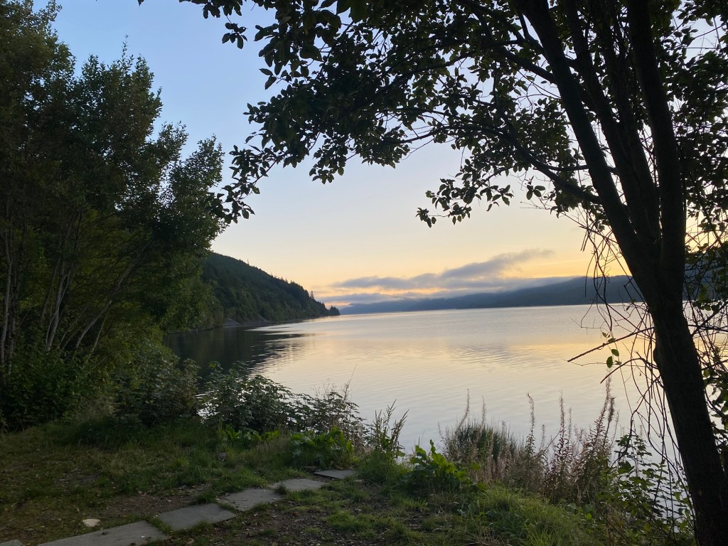
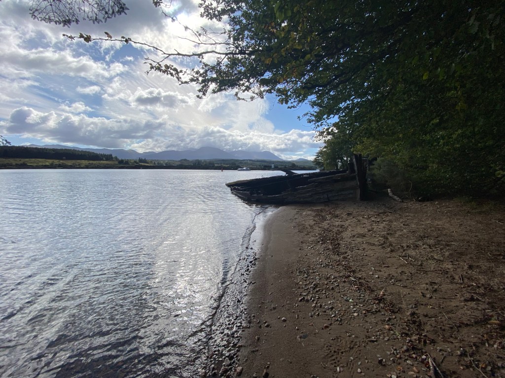
As the name suggests, the Lochside Hostel was right beside the Loch Ness. As it was a shorter hiking day of 16 kilometres, I had time to relax and read at the hostel. The sunny weather made sitting on the shore of the Loch pleasant and so I spent the better part of my afternoon and into the evening there.
Loch side at my hostel.Morning sun from the Lochside Hostel in Alltsigh.
I slept well after a long day of hiking on day two, but also had the advantage of not having any roommates in the dorm room I had booked. The sun was shining as I started out from South Laggan with the plan to go around 15 kilometres to Fort Augustus.
The Caledonia canal on entering Fort Augustus from the south.
The route was following the Caledonian Canal up to Loch Oich. The way cut west of the Loch to Invergarry and then headed north past the end of the Loch to Fort Augustus. The day was pretty uneventful. The small clusters of houses I passed revealed some nice vantages of the lake. I walked through various forested areas up over hills to the west of the lake. At the north end of Loch Oich I walked between the River Oich and the Caledonia Canal on my way to Fort Augustus.
Morag’s Lodge where I spend the night in Fort Augustus.
Fort Augustus is the largest town I was going to encounter until I got to Inverness. It was a more touristy location than I anticipated but I enjoyed wandering the town and learning about some of the local history. This was where Saint Columba is alleged to have engaged a mythical water beast who was threatening people on the southern shore of the Loch Ness. From the sixth century the idea of there being a water beast led into the myths around the Loch Ness monster. It also helped create an active monastery that later became a school and now a high-end resort in Fort Augustus.
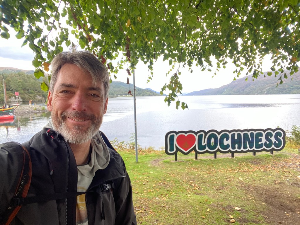
Obligatory “I love LochNess” picture.Where the Caledonian Canal enters the Loch Ness. Former Fort Augustus Abbey and now the Highland Club.
When I booked my hostels for the Great Glen Way, I realized that I had done this a bit late. I would learn from others that there is an increased number of people walking the Great Glen Way in September as the families that had booked holidays over the summer months were pulled back to school and work. This meant that I ended up finding a hotel that was “in the Fort William Area” but was actually almost 30 kilometres away just outside of Roybridge.
Early morning sun in Roybridge.
For my second day on the Great Glen Way I had the double whammy of also not considering that I was heading back on a Sunday when local buses were not running to Roybridge and the train was delayed until the afternoon. This resulted in my choosing to walk the entire way back to Gairlochy in order to get back on the trail. Based on Google Maps it looked like, by following the road, you could get there in around 13 kilometres, then I would have around 19 kilometres up the west side of Loch Lochy to my destination of South Laggan. During the extra day I had in Roybridge, I had seen there was a back route across grazing fields from my hostel that crossed the Spean River at Spean Bridge. I didn’t fully realize that this would add an extra three to four kilometres to my route until I got to Spean Bridge. However, I still feel it was a good choice to avoid having to walk on the side of a moderately busy road.
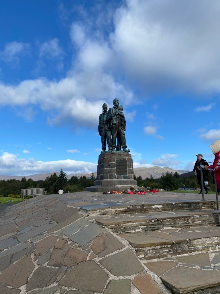
Commando Memorial in Spean Bridge.
At Spean Bridge I stopped for a break with a coffee and a pastry. Then I continued on, now following the road. People had noted the Commandoes Memorial at Spean Bridge. Originally I thought it was signed I had seen in the town itself, but as I climbed out of Spean Bridge, I came across a memorial at the top of the rise that looked out over the Spean River valley. The memorial was there to partly recognize the role that the area had played to training commandoes in World War Two. This had been a base of training. Throughout the day I would pass plaques next to Loch Lochy where additional information on the training for water to land assaults had occurred or further training had been delivered. It added to the experience of seeing the memorial. Behind the statue was a small garden that had a number of plaques recognizing groups or individual commandoes.
Back on the Great Glen Way.
A couple kilometres beyond the memorial was the swinging bridge at Gairlochy. On arrival it was open to allow a boat to pass through the canal. It gave me a chance for a short break and to see how the swinging bridges worked. Then it was back on the Great Glen Way.
Lunch spot on Loch Lochy.
The path took me in and out of small villages—mostly just clusters of houses rather than anything formally organized—and cut from next to the Loch to further inland. Sometimes on roads but mostly on paths near the road. The highlight was walking through the Clunes National Forest, a beautiful older growth area that included some managed forests. Although relatively flat there was a some hilly areas and some views across Loch Lochy that were nice to see.
Bear sculpture outside of Clunes National Forest camping area.
By the time I got to the end of the day, I was glad to get to Laggan. I missed that the village—or collection of houses that makes up South Laggan—was on the road but not on the Great Glen Way path that cut to the east side of the Caledonian Canal as you got to the north end of Loch Lochy. This meant that I had an extra 500 metres to walk as I had to backtrack on the road to the delightful Great Glen hostel. The hostel/hotel had a nice restaurant and was in an old farmhouse that had been remodelled as a hostel it was today.
A few years ago my Dad had given me a few books by John Preeble that each covered a different aspect of Scottish history. One was on Glencoe and the 1692 massacre of the members of Clan MacDonald by the Campbells. Along with images of the harsh and beautiful landscape, the book had brought the idea of going to see Glencoe to the forefront of my mind.
River Coe
I took a bus from Fort William (or An Gearsedan as my Dad insists on calling it by its Gaelic name) that conveniently had a stop at the Glencoe Visitors Centre. This Visitors Centre is predominantly there to support the work of the Nature Preserve that now encompasses much of Glencoe, but also had information about the history and the massacre, including a short video informing visitors of this tragic past.
From Bridge at Ballachulish on way to Glencoe from Fort William
The weather on my visit wasn’t ideal in the morning and, as many hikes suggested that good weather was required to ensure safety, I chose to do a hike to one of the nearby hills. This gave me a good view of the towns of Glencoe and Ballachulish and a view of the Sea to the west, and also a look down to the east of the Glencoe valley. Although it was listed as a three-hour hike, I was able to complete it in a bit under two hours. This left the better part of the afternoon to look for other ways to fill the time before my 1745 bus back to Fort William.
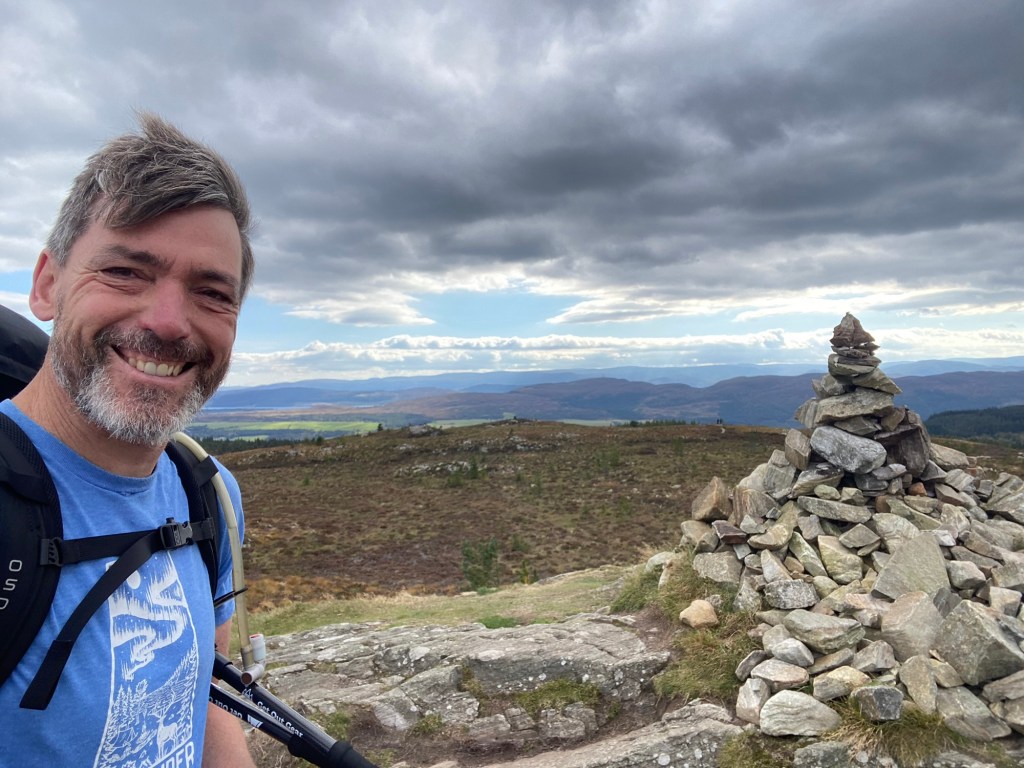
View from peak of An Morr.
As a result I decided to wander into the Glen to see more. The park has great walking paths that made walking into the park easy. I was able to follow these paths to where I could do a short walk to Signal Rock—a rock that was once thought to be where the Macdonalds would light a flame to alert those farther in the valley of danger, but more recently was felt to have got this name from a derivation of the worship of the sun from the pagan ancestors of the Scots. These site was no longer one that could provide a vista of the valley—the park signs made certain to note this in order to ward off frustration of people who choose to walk to the rock—but was surrounded by tall trees which were gifted from Lord Strathcona but had grown to distract from the site over time. My wanders went as far as Loch Achtriochtan Before I needed to head back to the Vistors centre to catch my return bus to Fort William.
I had a couple nights in Banavie just northwest of Fort William at the Chase the Wild Goose hostel. During this time I visited Glencoe and walked the initial five kilometres of the Great Glen Way from the old Fort of Fort William to Neptune’s Staircase—the series of lochs leading from the sea to the Caledonia Canal. The Great Glen Way continues north from the Staircase to Gairlochy, the point where I would end the trail on the Great Glen Way for day one of my hiking.
My day one trip would take me to Gairlochy and then off the main track to Roybridge, a town nine kilometres east of Gairlochy which was the closest I could find a hostel for the first night. I realized a bit too late that the hostel was an additional couple kilometres east of Roybridge which definitely added to my step count for day one.
The path from Banavie to Gairlochy was largely uneventful other than having to get suited up in rain gear when the rain started coming down in earnest when I was midway up the trail. The path was a relatively flat path that ran along the east side of the Caledonia Canal. Occasionally you could see the river below on the east, but typically the trees blocked this view. The flat, well maintained path kept me moving steadily to complete the 12 kilometres I had to Gairlochy.
On arriving at the Gairlochy bridge, I turned east to follow the road towards Spean Bridge. This was around six kilometres around the winding but relatively flat road where I had to watch for the odd traffic due to the narrowness of the path. In Spean Bridge I stopped to eat at a local cafe before catching a bus to Roybridge. Then I walked the last two kilometres to my hostel, Aite Cruinnichidh, a quiet but pleasant hostel in a rural setting next to the Spean River.
I had plans when I was thinking of my year off of continuing travel in Eastern Europe and Turkey, but then had my 81-year old father ask if I would join him as a driver on a week in Scotland. For the past week I have had the fun of driving on the left hand side of the road and taking my Dad, his wife Marion, and my sister Fiona to a few sites near Pitlochry, Scotland.
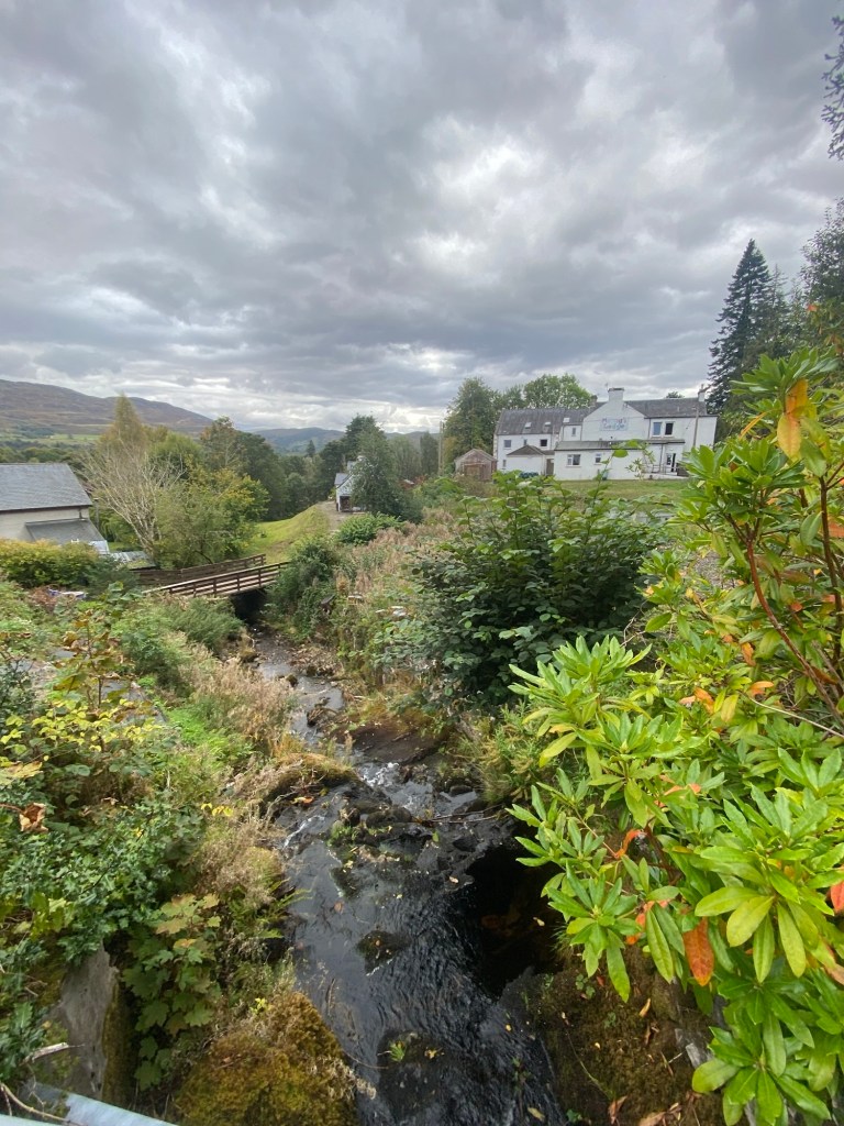
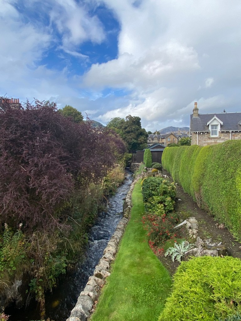
One of the streams running through Pitlochry.
Pitlochry is a small town with a bit of a tourist feel. It has a lot of walking routes connected to it, is close to the Cairngorm Mountains, and has fostered a local tourist experience with stores, spas, and local activities to appeal to a range of tourists.
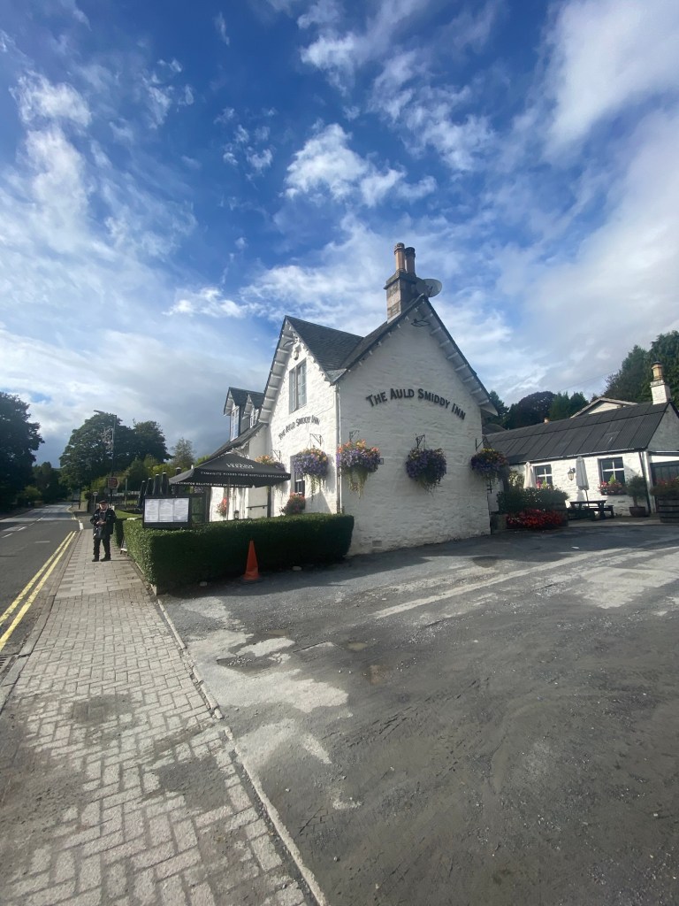
The Auld Smiddy: one of the many pubs in Pitlochry
My dad is waiting for a hip replacement and was in some pain following his flight. This made is mobility somewhat limited, but he still wanted to ensure he got out to see as much as possible.
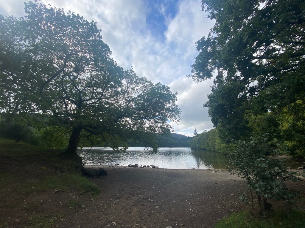
Loch Faskally, a made man lake formed by the Pitlochry Dam.
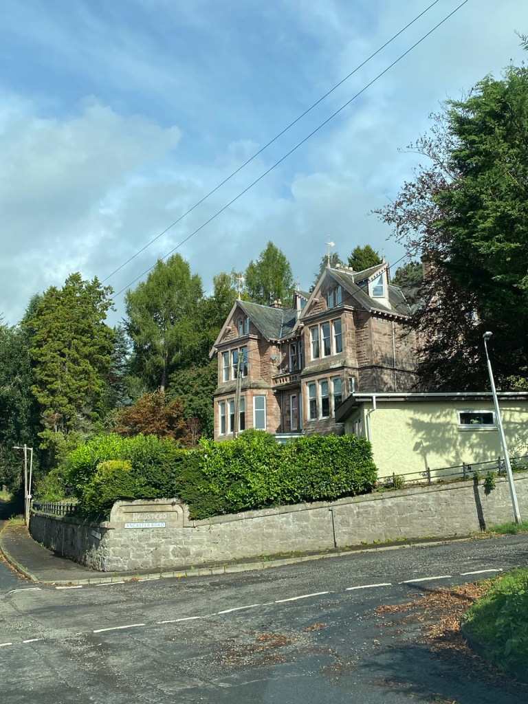
Our first full day we went to see Crieff and Aberfeldy. Crieff was a town where my Dad went to school as a boy. It was interesting to hear of the sites he had spoken off including his old school and boarding house. It was a great chance to hear about his experience and better picture his stories. Aberfeldy was a small town that we stopped in for lunch (haggis bon bons were on a few menus but this was where I first tried them). Just outside of Aberfeldy was Castle Menzies, the ancestral home of the eponymous family. It had fallen into disrepair after the start of the 20th century and had been fixed up over the past half century by a group trying to preserve its history. It was an interesting example of how a 16th century keep could be reinforced and redeveloped overtime to create a stately home. The lower level was in its rougher more original feel, but the upper floors had been returned to their condition as they would have been in the late 18th to mid-19th century. One of the tower rooms claimed that it had been where Bonnie Prince Charlie spent a time on his way to Culloden in 1745. On the way home we made a quick stop at the Dewar’s distillery. Although all the tours were booked it was good to see the site and their store.
Newstead: the home my dad lived in for part of his time in Crieff. Castle Menzies. The Dewar’s Distillery.
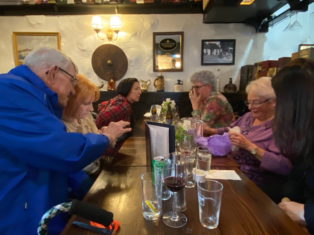
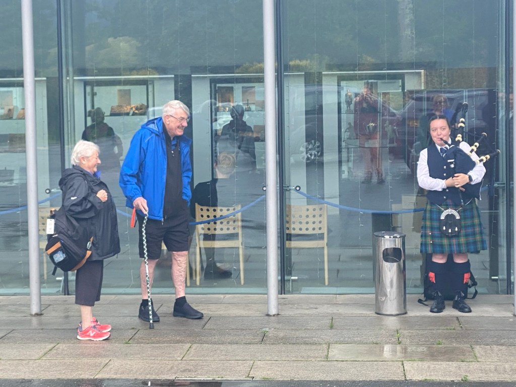
My Dad’s cousin’s wife and her daughter came up from Glasgow on Friday evening to join us to watch a pipe band parade that was occurring on Saturday morning. I had met Dorothy and Claire on a previous trip to Scotland, but it was good to see them after all this time. It was good to spend time with them. The pipe band parade was relatively short with only about ten bands marching. It was good to see the crowds and hear the music as they marched past. My Dad had a hotel room looking out on the Main Street where the bands were marching past and was excited to be able to watch them from the comfort of his own hotel room. After a nice lunch with the cousins we bid them adieu with the plan to meet the broader cousins the following day.
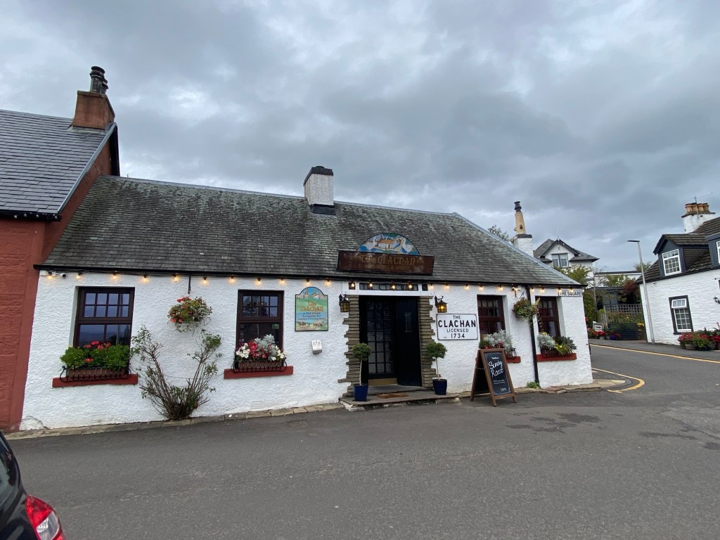
On Sunday, we drove out to Drymen to meet the Cousins at The Clachan, a pub that claims to be the oldest in Scotland. On their sign they indicated a 1734 incorporation as a public house. It was a cool little pub and allowed us a great opportunity to connect with our cousins over a Sunday Roast. It was also fun to see some more of the Scottish countryside, including a drive past Stirling Castle. Although likely not the highlight of the trip, once back in Pitlochry, I had the opportunity to try haggis ice cream. Surprisingly better than I expected, but likely a one time thing.
The Clachan in Drymen. The Cousins after lunch at the Clachan.
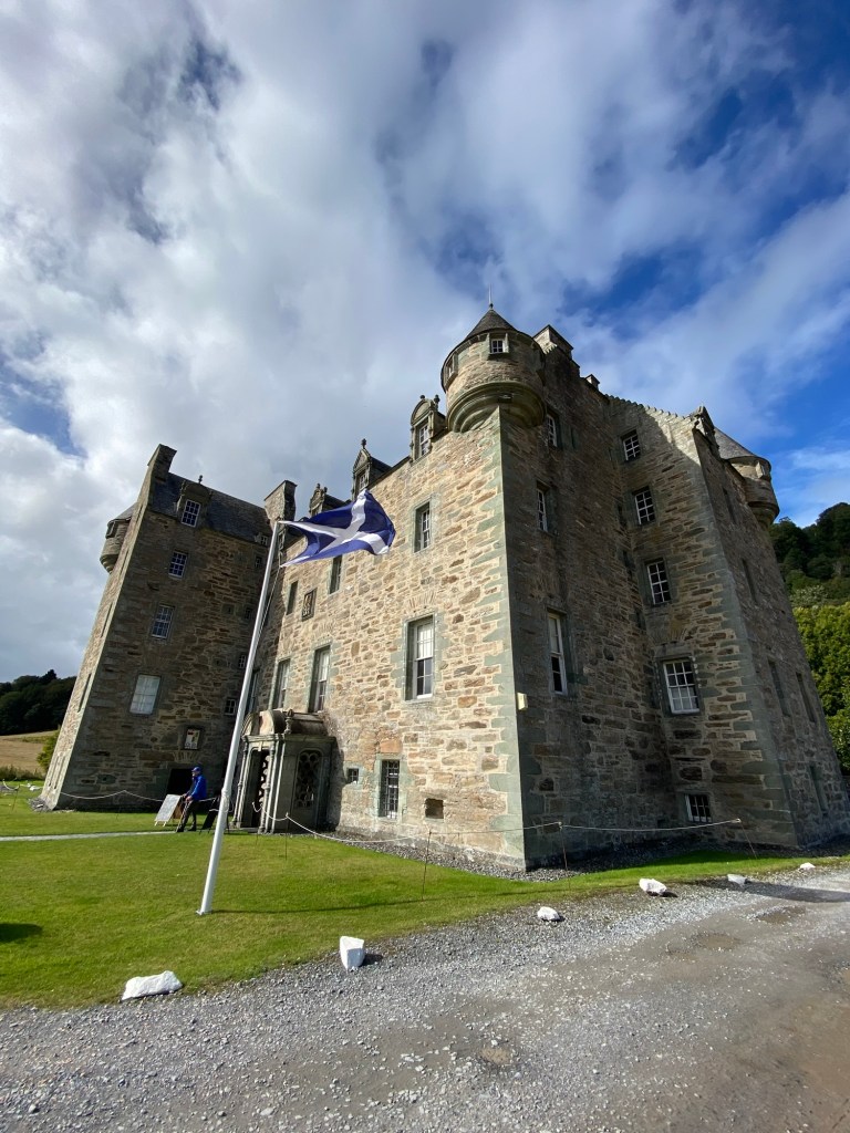
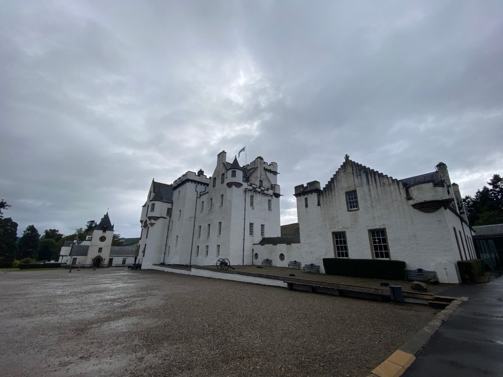
The next day we had a more relaxing day. Fiona and I explored a bit of the area around Pitlochry before she left to return to Romania. Dad, Marion and I went to see Blair Castle. It was about 12 kilometres from Pitlochry and was the home of the Dukes and Earls of Atholl. It was a very stately home that had been maintained in great condition along with significant gardens and grounds. The house included an audio tour that helped to explain the castle and its history. It was a good experience to explore the home.
Blair Castle.Dad and Marion enjoying the piping at Blair Castle.
Pitlochry was also a great town to just wander around. Its scenic environment and picturesque setting made it enjoyable to wander and take pictures. It had an extensive array of eating establishments with good food and drinks. It added to the enjoyment of spending time with my family in Scotland.
The Moulin Church/Heritage Centre and graveyard. Haggis ice cream from Pinchy’s in Pitlochry.
With an alleged 365 churches around Lake Ohrid, Macedonia, it has been called the “Jerusalem of the Balkans”. I had wanted to visit this part of the world since I read Kapka Kassabova’s “To the Lake: A Balkan Journey of War and Peace”. Although my travels were never going to be as in depth as Kapka’s in this book, the intriguing nature of this part of the world with the connections to lakes, religion, and borderlines.
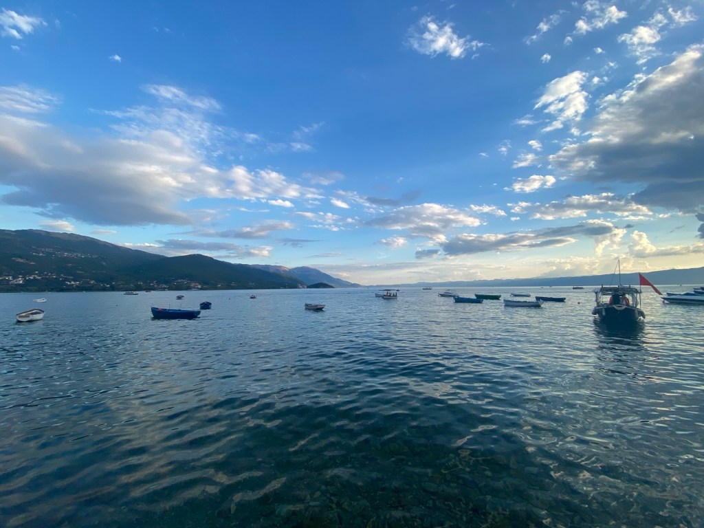
Ohrid waterfront.
Ohrid is a picturesque city on the northeast corner of Lake Ohrid. In coming from Tirana, Albania, we drove east to the western side of the lake before taking a turn to make the clockwise turn around the lake towards Ohrid the city. I was on the wrong side of my bus to take full advantage of looking out the window and seeing the lake, but even through the other passengers, there was something magical on the sun glinting off the water as we made our way around.
Sunset in Ohrid
I booked the Blue Lake Hostel, just a few blocks from the waterfront, and 500 metres from the main wharf, square and the edge of the old city. It made the exploration of the city a lot easier.
Although I wanted to do some hiking, I mostly wanted to explore the sites within Ohrid and the area. Usually I would quickly look up the free tour of the city, but for Ohrid, I wasn’t able to find one for a couple days after my arrival. Although I booked one based on feedback from a Welsh man I met in Tirana, I looked to fill some time with a trip to the St. Naum monastery on my second day around Lake Ohrid. I had heard a few good things about this monastery and saw it advertised as part of a regular rotation of boat trips one could take from Ohrid. The tour took us down the Macedonia side of Lake Ohrid. We went by the old summer home of Tito, the Bay of Bones—a bronze area waterfront town that had been reconstructed from the remains of the posts that were left in the water at the Lake’s edge—before we came to the Monastery on the southeast corner of the lake, a few kilometres from the Albanian border.
St. Naum’s Monastery from the water.
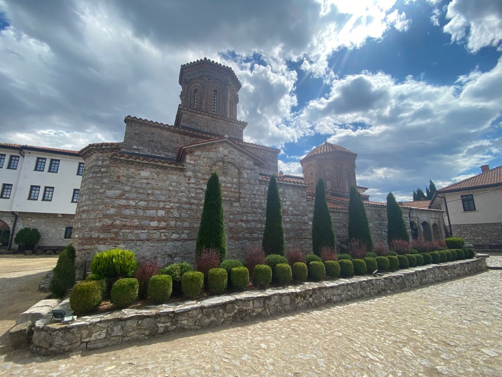
St. Naum’s monastery was deeply tied to the history of the Lake. In the tenth century St. Naum set up his monastery on the south end of the Lake at the same time that St. Clement was developing his monastery and school in Ohrid at the north end. These two were instrumental in developing a more functional Cyrillic text that the common person could read. They built on the work by their mentors, St. Methodious and St. Cyril (who the improved text was renamed after), and this endeared them to the people they served around Lake Ohrid. The monastery at St. Naum is no longer an active monastery although there are rooms and a restaurant to support people visiting from monastic traditions and pilgrims wanting to stay at the site. Much of the monastery has been rebuilt over time as it was destroyed by the Ottomans in the 15th century with the locals rebuilding shortly afterwards. Under the communist leadership of Yugoslavia it was a cultural site but not really supported. Post-independence in 1991, the cult of St. Naum came back in earnest with a redevelopment of the site occurring at the same time. This has made it one of the most popular tourist sites in North Macedonia. Adding to the setting is a clear river that connects Prespa Lake and is fed by multiple springs in the area and a sand beach that spreads out west of the stream along the shore of Lake Ohrid. Even on a “slow” day, according my guide, there were hundreds of people visiting the site.
The church at St. Naum’s Monastery
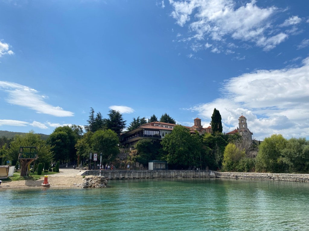
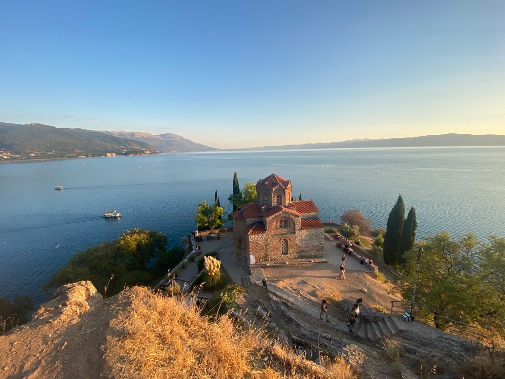
Ohrid earns it reputation for churches well. The tour took us to eight churches—some just in passing, others with more deeper history—but walking around the city there are churches around most blocks. Many have history that goes back multiple centuries despite the presence of Ottomans in the area. The cathedral of St. Clement is a rebuilt church on the site of a Roman area church that was four or five times its size. Macedonia is supporting the redevelopment of a college at the site after hundreds of years without a university, the new buildings can be seen stretching along the coastal area next to the cathedral. Just around the corner from the Cathedral one of the most scenic churches in Ohrid can be found. The Church of St. John of Kaneo is on a small peninsula that allows it to have water on three sides at the edge of Ohrid’s old city, just under the hill where the Cathedral of St. Clement sits. Despite its picturesque nature, the history of this site is not apparent. Along with many other churches the importance of why it was built in the first place is lost.
St. Clement’s Cathedral. Church of St. John of Kaneo.
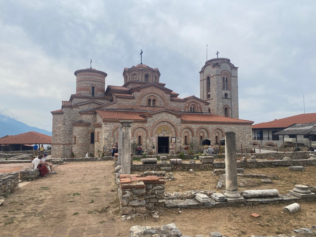
Beyond the churches the Old city has Roman ruins and a Fortress with history from Roman and Ottoman times. Much of this history is still being found. When I visited the fortress you could see a large archaeology dig occurring at the site to learn more about the history of a fort that appears to have some history going back two millennia, even if the main existing structure is from the 11th century.
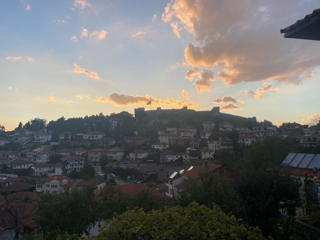
The old city of Ohrid with the fortress at the top.
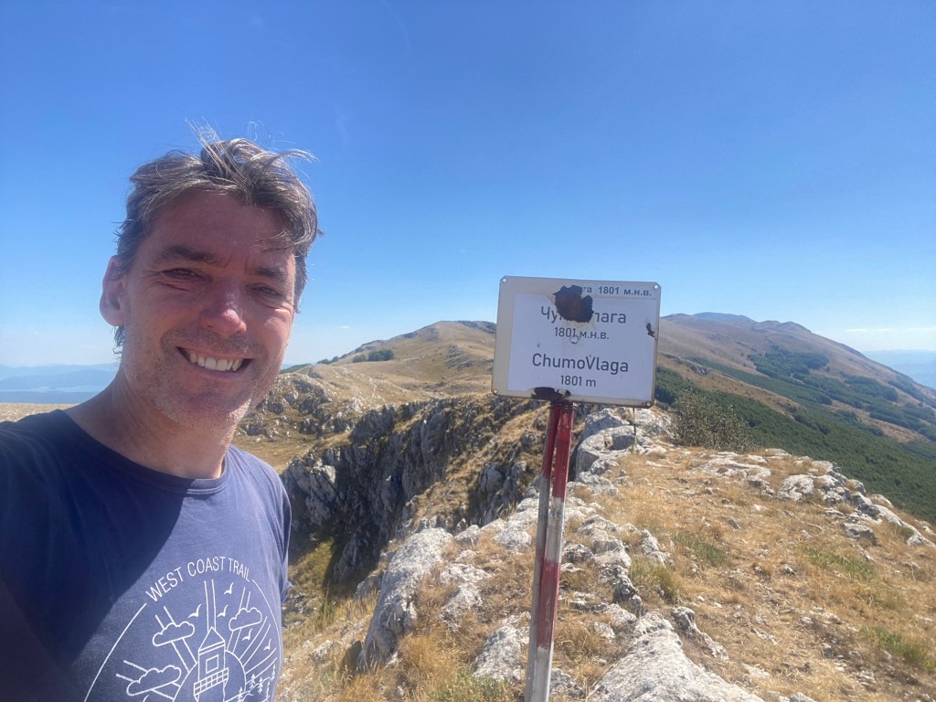
As well, east of Ohrid and stretching south between Lake Ohrid and Lake Prespa is the Galicaca National Park. From reading Kapka Kassabova’s history of the area, I wanted to get a visual of Lake Prespa. I chose to do this by hiking to the peak of Chumo Vlaga. Although there are higher peaks (six in the national park if I understood what I read) this was a healthy 16km from the park entrance near Ohrid and allowed a nice view of both lakes once I was at the top. A long hike back to Ohrid made for a tiring but satisfying day.
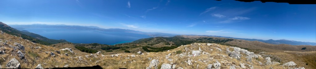
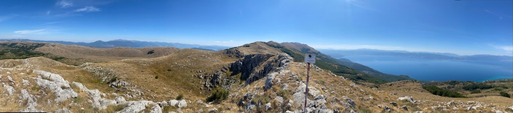
Panoramic east of the ChumoVlaga peak. Lake Prespa in the background.Panoramic south with both Lake Prespa (left) and Lake Ohrid (right).